










Identify critical areas.
Assess vulnerabilities.
Strengthen resilience.
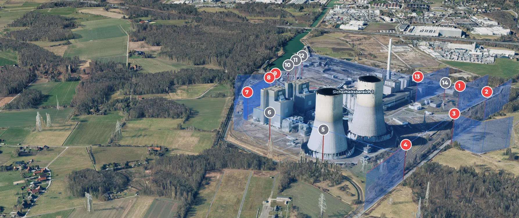
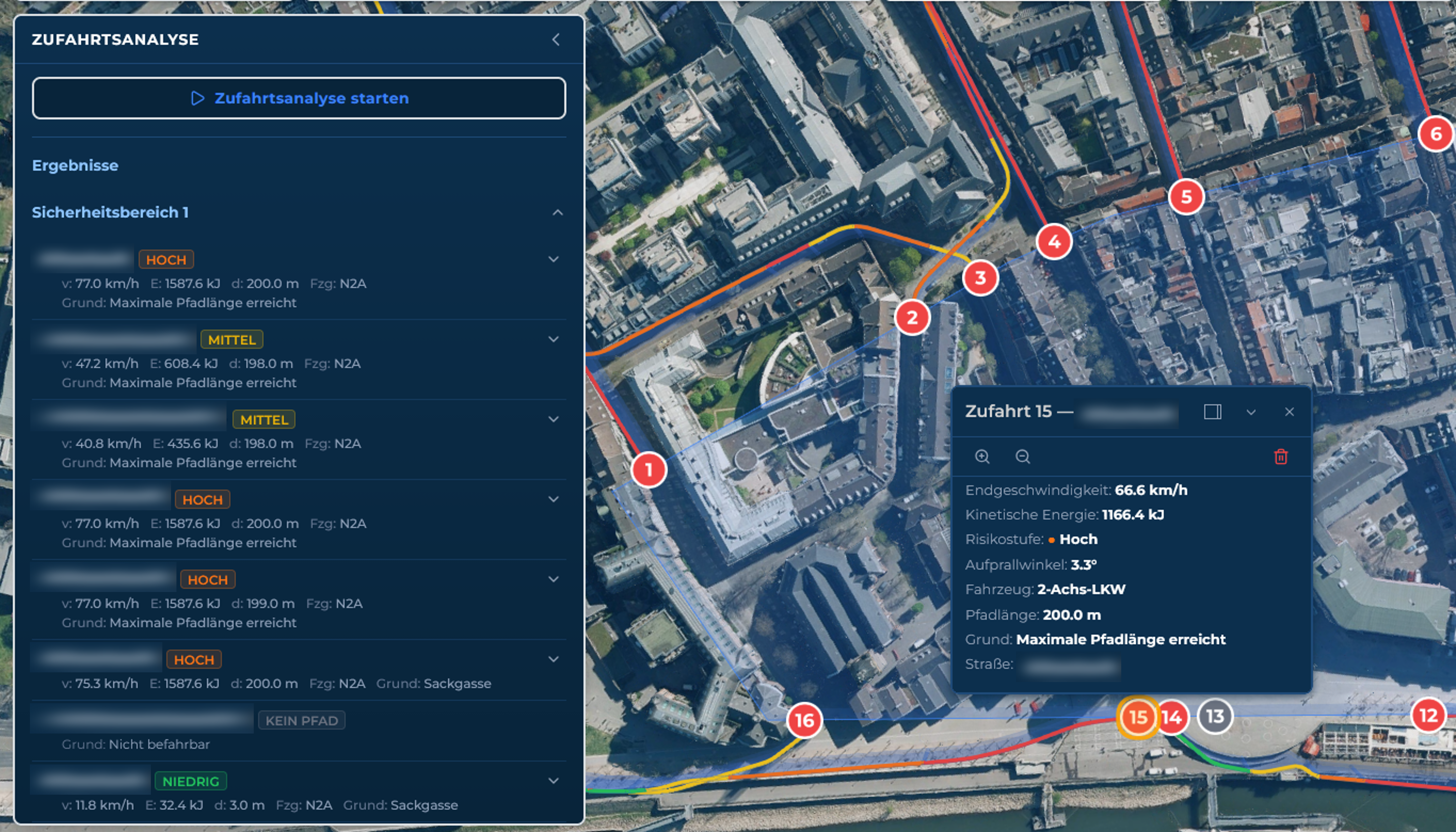
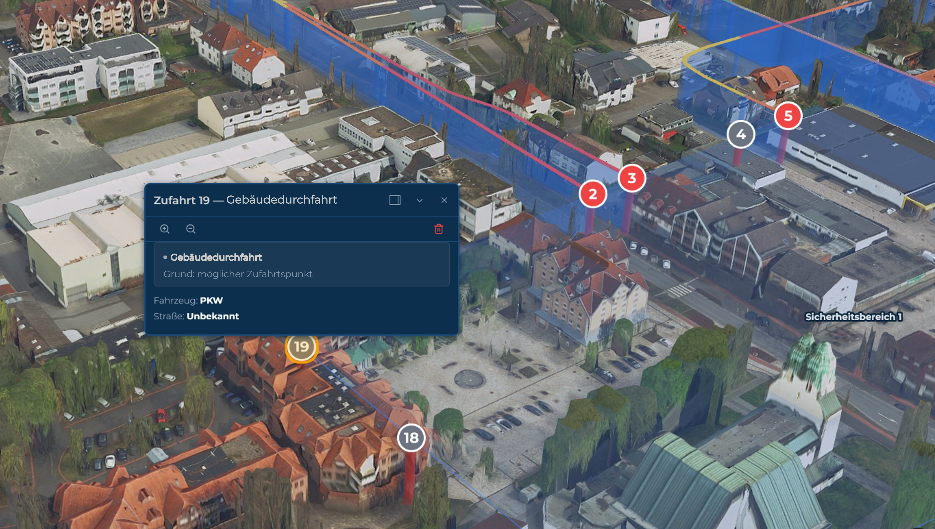
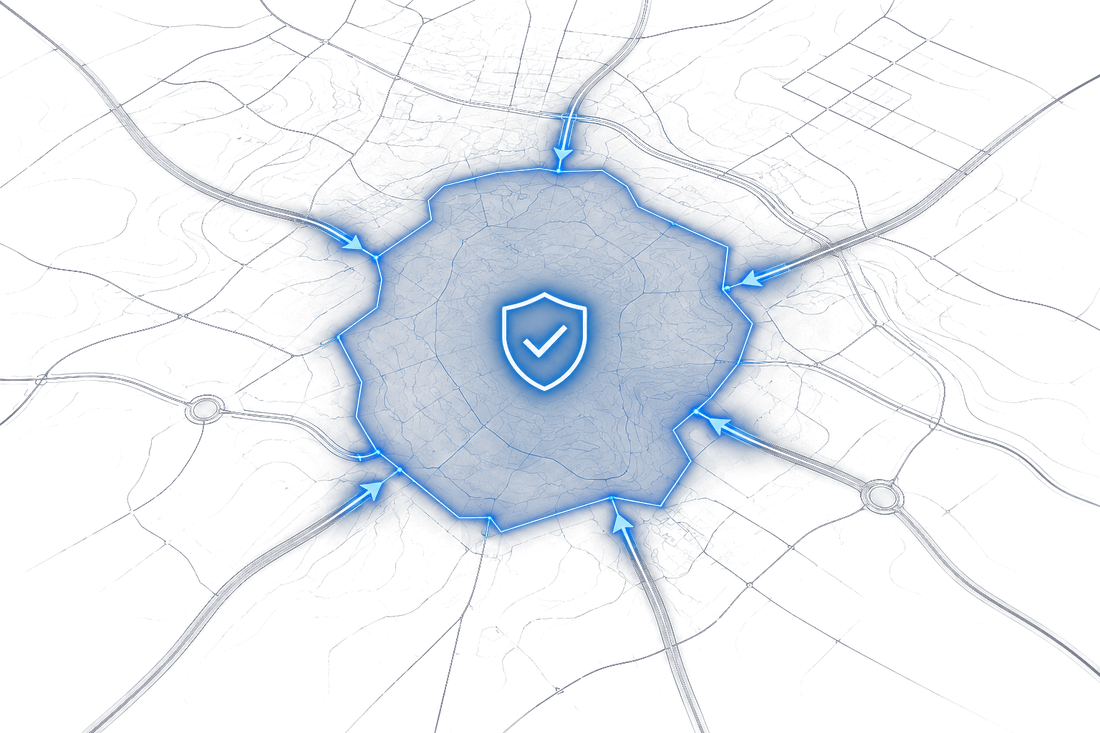
Barricadix delivers AI-powered security analyses for the early detection of critical vulnerabilities. Based on geospatial, satellite, and infrastructure data, we analyse attack scenarios, exposed areas, and protection priorities for public spaces, critical infrastructure, and military sites.
Complex security assessments become data-driven, comparable, and decision-ready with Barricadix.
Consolidate data
Geospatial, satellite, and infrastructure data are made usable within a shared operational picture.
Assess risks comparably
Vulnerabilities, attack scenarios, and protection priorities are analysed in a structured and traceable manner.
Accelerate decisions
Operators, planners, and authorities develop coordinated vehicle access protection and security concepts on a shared data foundation.
Barricadix connects data, analysis, and actionable recommendations into a digital security process for well-founded decisions in public spaces, critical infrastructure, and military sites.
One platform.
Six modules.
Everything on one platform: analyze, design protective measures, document, and tender — standards-oriented and seamless from start to finish.
Vehicle Dynamics Analysis
Assessment of approach routes, attainable speeds, and impact energies for a realistic evaluation of vehicle threats.
Learn moreAttack Scenario Analysis
Simulation of relevant attack scenarios to identify exposed areas, vulnerabilities, and critical approach points.
Learn moreRisk & Threat Analysis
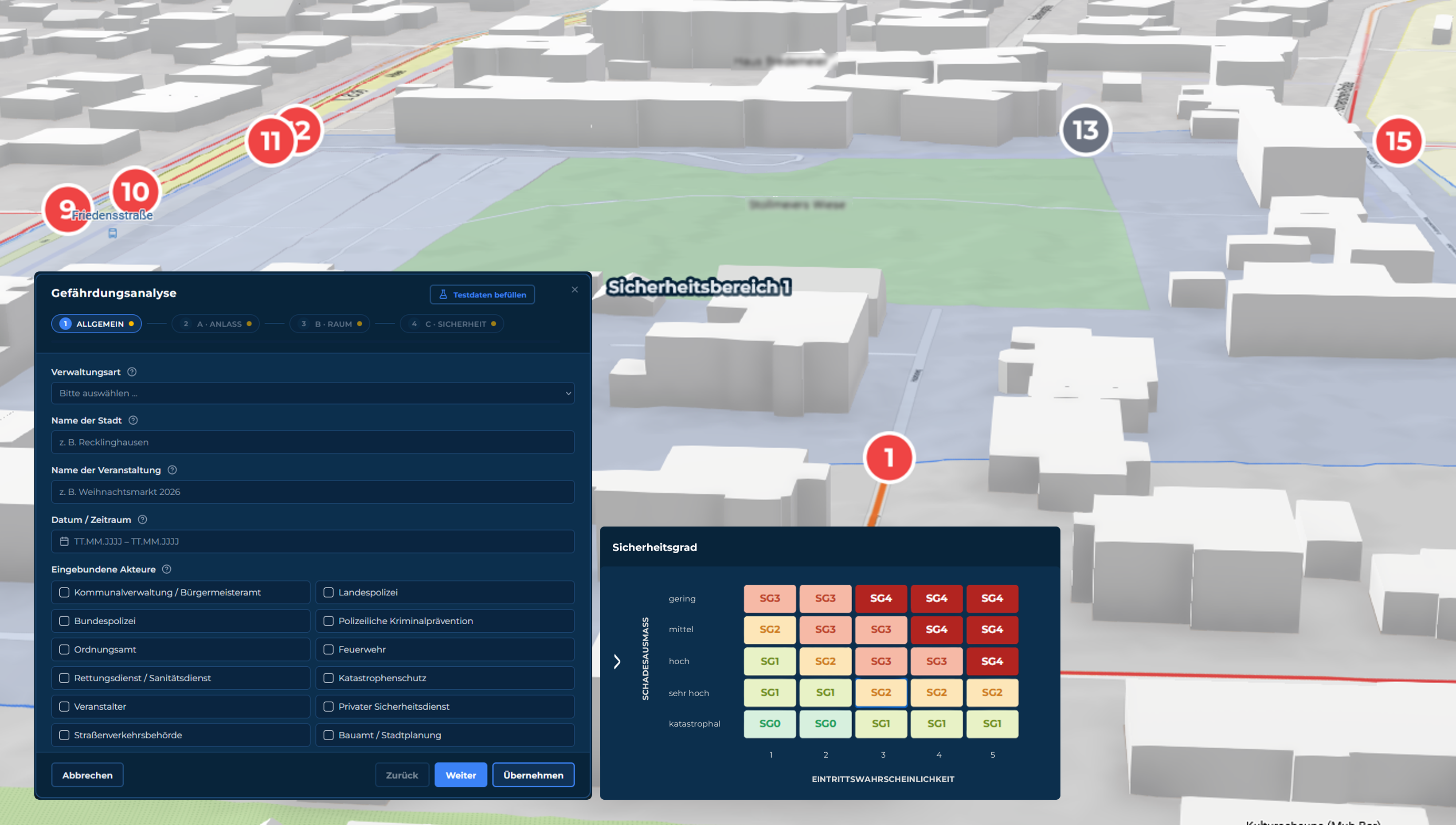
Identification of potential perpetrator behaviour and attack patterns through data-driven analyses, machine learning, and crime-prevention assessment methods based on CPTED. Situational, spatial, criminological, and other security-relevant factors are taken into account. Results support the determination of the threat coefficient in accordance with DIN SPEC 91414-2.
Learn moreRecommendation & Design of Protective Measures
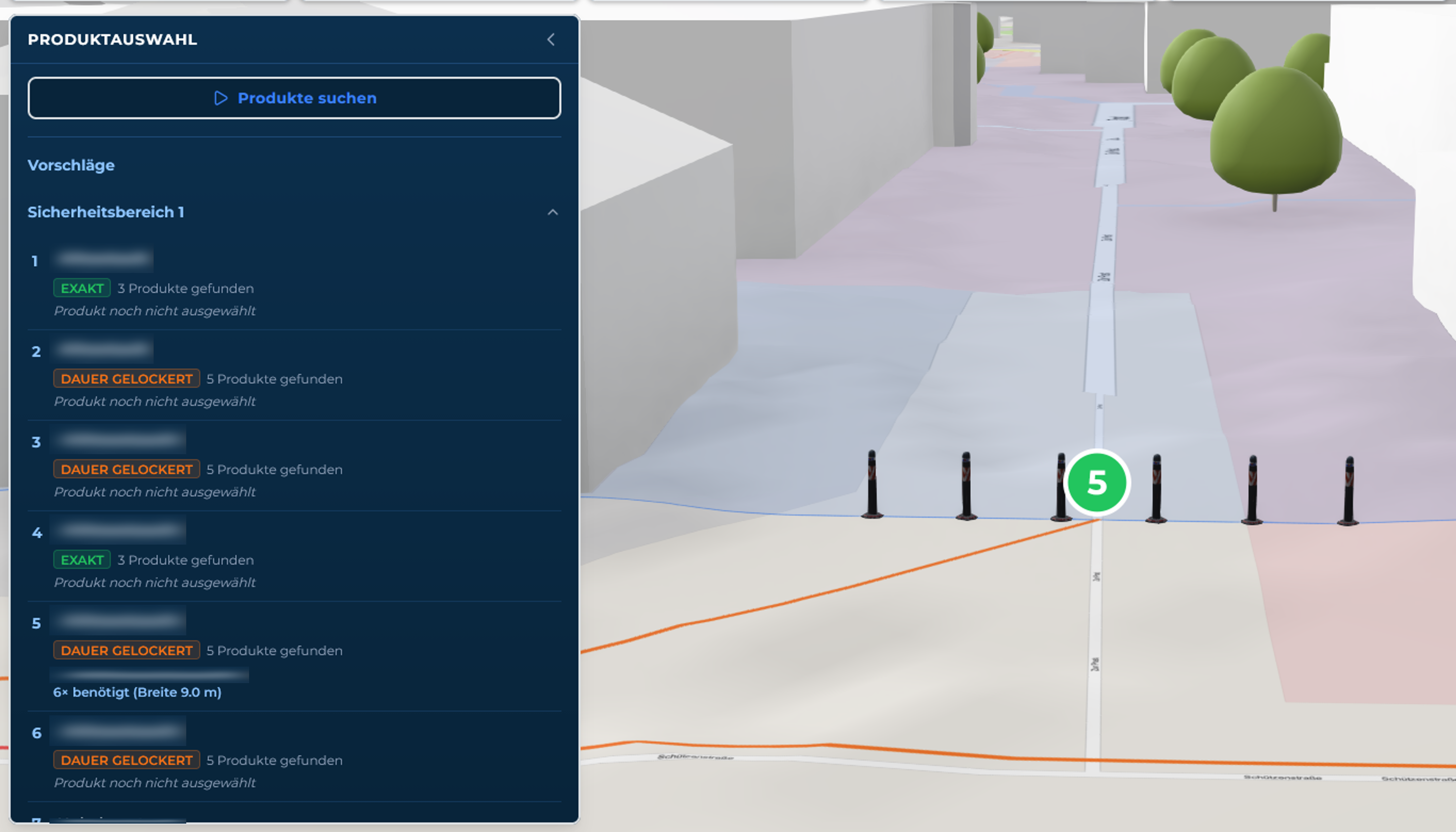
Manufacturer-neutral recommendation as well as design and arrangement of suitable, certified protective measures (bollards, vehicle barriers, barriers, security fencing, boom barriers) in accordance with the requirements of DIN ISO 22343 and the Technische Richtlinie Mobile Fahrzeugsperren v0.8.
Learn moreRisk Report
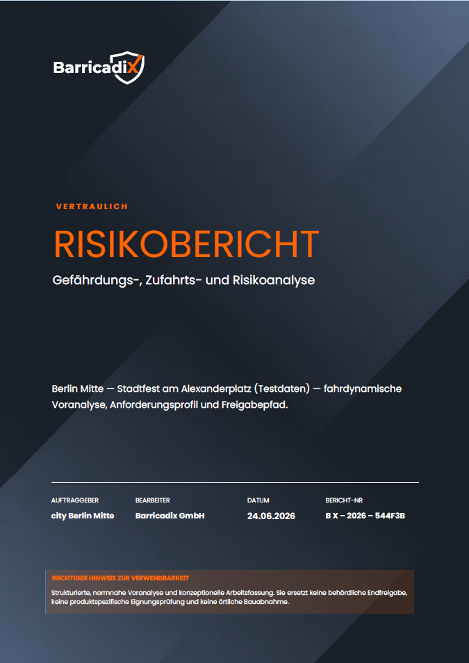
Automated generation of a comprehensible risk report in accordance with relevant standards. Structured, justifiable, and usable by operators, planners, police, and authorities.
Learn moreTender
Automated generation of standards-compliant tender texts — from the specification of services to the structured, procurement-ready tender document.
Learn moreFrom geospatial data to reliable security decisions.
Barricadix connects geospatial, satellite, and infrastructure data with AI-powered analyses to make risks visible, assess vulnerabilities, and derive protective measures.
Capture geospatial data
Geospatial, infrastructure, and satellite data are consolidated into a shared analysis model.
Generate analyses
Threats, vehicle dynamics, and attack scenarios assessed automatically.
AI processing
Pattern recognition and standards-based consolidation into reliable conclusions.
Deliver results
Report, protective measures, design, and completed tender.
Capture geospatial data
Geospatial, infrastructure, and satellite data are consolidated into a shared analysis model.
Generate analyses
Threats, vehicle dynamics, and attack scenarios assessed automatically.
AI processing
Pattern recognition and standards-based consolidation into reliable conclusions.
Deliver results
Report, protective measures, design, and completed tender.
The complete security planning process.
Digital.
Barricadix is the world's only company to map the complete security planning process without gaps. From the initial risk analysis to the completed tender. No interfaces, no supplier chain, one continuous digital process.
Unique worldwideThe value for your security planning.
The Barricadix platform creates reliable decision-making foundations for security planning. By connecting geospatial data, physical calculations, and structured workflows, complex planning processes become simpler, more transparent, and more efficient.

Objective decisions
Uniform assessment methodology instead of subjective estimates. Risks are analysed traceably and assessed comparably.
Less coordination effort
Municipalities, operators, authorities, and specialist planners work on a shared data foundation — for faster and better-informed decisions.
Traceable documentation
All analyses, assumptions, and recommendations are documented transparently and form a reliable basis for planning, communication, and verification.
Reduced planning effort
From risk analysis through protective measure planning to a procurement-ready tender in one continuous digital process.
Security planning.
For every application area.
One platform for all application areas in which vehicle access protection (HVM), perimeter security, and objective security assessments are required.
Municipalities
Public space
KRITIS
Critical infrastructure
Event organizers
Events & audiences
Defence
Defence & military
Security in practical use.
COOPERATION HÖVELHOF
Working with Barricadix gives us additional capabilities to identify risks at an early stage and to further develop our security measures in a targeted manner.
Frequently asked questions
What is perimeter protection and perimeter security?
Perimeter protection is designed to effectively protect a secured zone against unauthorised access and vehicle attacks. Barricadix supports security managers in the analysis, assessment, and planning of the necessary protective measures.
Is Barricadix suitable for vehicle access protection at events?
Yes. Barricadix was specifically developed for the analysis and planning of vehicle access protection measures. The platform identifies critical access routes, assesses potential vehicle threats, and supports the selection of appropriate protective measures.
Is Barricadix also suitable for critical and military infrastructure?
Yes. Barricadix is suitable for events as well as critical infrastructure, industrial facilities, and military sites. The platform supports the analysis of potential access risks, the assessment of threats, and the planning of suitable physical protective measures for a wide variety of application scenarios.
How long does it take to produce a risk analysis?
The duration depends on the size and complexity of the protected area. Through digital analysis, automated assessment processes, and intelligent workflows, risks can be assessed significantly faster than with a purely manual approach.
What results does Barricadix deliver?
The platform produces digital risk and threat analyses, recommendations for protective measures, risk reports, and procurement-ready specifications and tender documents.
What can the results be used for?
The results serve as a reliable basis for security concepts, coordination with authorities, internal decision-making processes, and the planning, design, and tendering of appropriate protective measures.
Does Barricadix take current standards and guidelines into account?
Barricadix's assessment methodology is aligned with the requirements of relevant standards and regulations, including DIN ISO 22343, DIN SPEC 91414, and the Technische Richtlinie Mobile Fahrzeugsperren. This enables the platform to support structured and traceable security planning.
Are the tender texts compliant with procurement law?
Barricadix produces structured, manufacturer-neutral specifications as the basis for a procurement-law-compliant tender. The final review for compliance with procurement law is carried out by the respective contracting authority.
Complex security planning.
Made simple.
Discover how Barricadix supports municipalities, KRITIS operators, and security managers in the analysis, assessment, and planning of physical security measures.
Get in touch